Mangaluru’s Dual Flows of Progress
Interweaving water systems and transit lines for a climate ready urbanization.
This project was developed as part of the course, Thinking Landscape–Making Cities (DES 3396, Spring 2025), which was a design seminar at Harvard GSD that challenged students to assess climate change threats for a city of their choice and develop regenerative scenarios for mid-century and beyond. The course was structured around four foundational themes—Water, Infrastructure, Pattern, and Narrative—with the expectation that students would move beyond resilience toward regenerative solutions that support the capacity of all living and mineral systems. Through collaborative workshops, individual research, and multi-scalar thinking (micro and macro lenses), the seminar demanded both analytical rigor and the confidence to imagine transformative futures.
Mangaluru (Mangalore) was selected as the focus city to extend previous research on the changing dynamics of rural landscapes and regional anti-sprawl strategies. Where that earlier work examined regional-scale frameworks for curbing urban expansion, this project zooms in to the city scale—exploring how climate-resilient urban development can be structured to direct growth inward and prevent vulnerable coastal sprawl while addressing Mangaluru's specific water, transit, and governance challenges.
Mangaluru: From Port Settlement to Climate-Vulnerable Hub
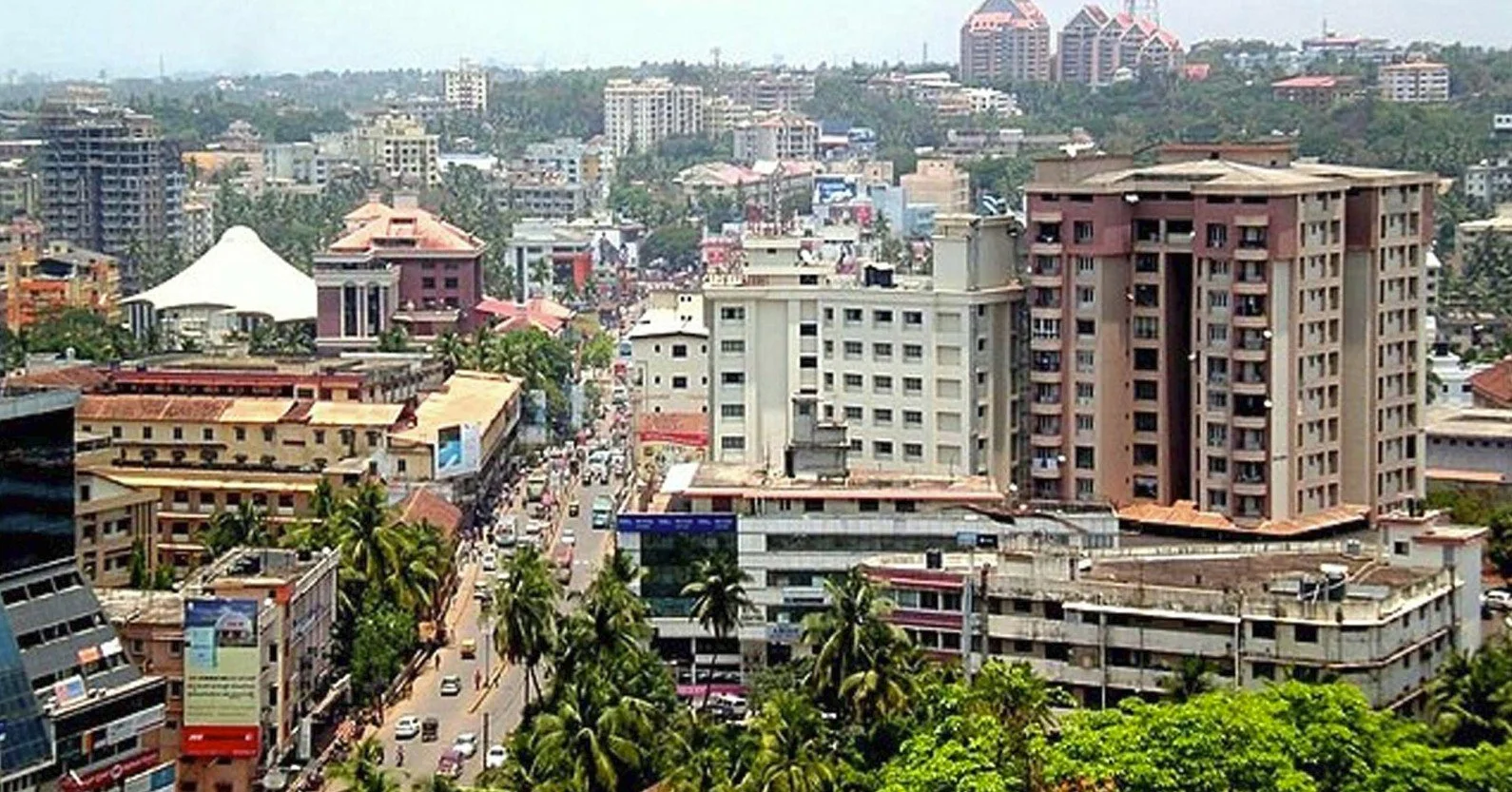
Mangaluru—derived from Mangala (the deity) and Uru (village)—evolved from a small settlement into a significant port city, first flourishing under regional and Arab traders, then rising to prominence during the Portuguese era in the 16th and 17th centuries as a vital center for maritime trade in rice, spices, and textiles. Today, it is Karnataka's second-most important economic hub after Bangalore, recognized for its major port, thriving industries, and status as a commercial, educational, and technological center.
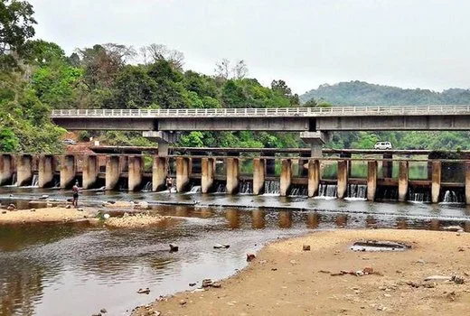
Yet this rapid growth has brought profound challenges. Mangaluru is developing at an accelerated pace, with high-rise residential projects transforming the skyline, but transit infrastructure has not kept pace—resulting in increasing traffic congestion and rising pollution. Historically shaped by two major rivers, the Netravathi and Gurupura, which followed separate courses to the Arabian Sea, the city's unique estuarine landscape is now under stress from both natural and anthropogenic changes.
Climate Risks: Dual Threats of Flooding and Scarcity
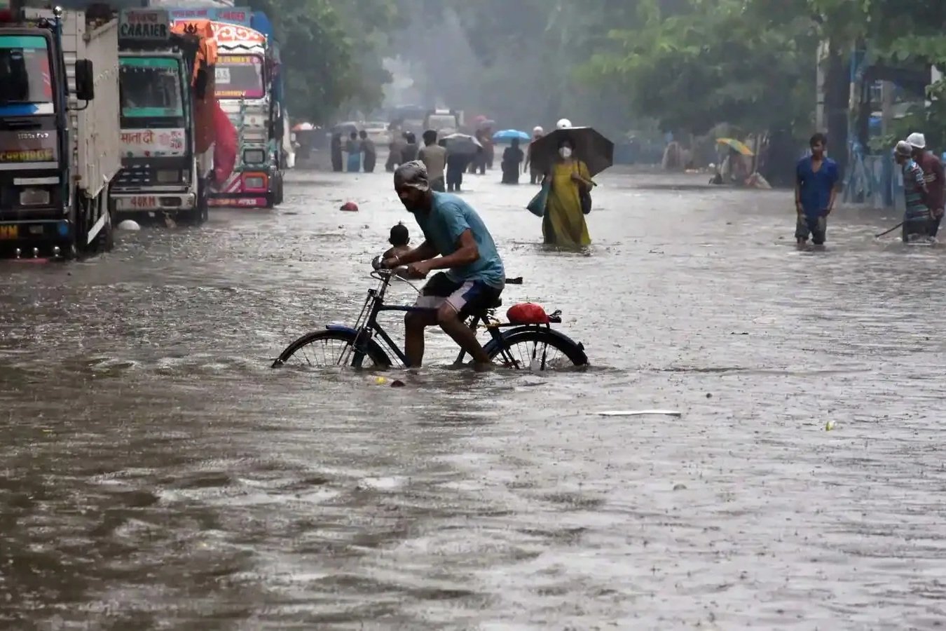
Mangaluru faces inland flooding more acutely than coastal inundation. Heavy monsoon rains cause the Netravathi and Kumaradhara rivers to overflow, inundating low-lying urban and rural areas. Urbanization and agricultural intensification have altered rainwater drainage and soil movement across the Netravathi basin, exacerbating flood risks during the Southwest monsoon. Despite this seasonal abundance, the city experiences water scarcity during the dry season, when dam levels drop and some neighborhoods face acute drinking water shortages.
Long-term projections add urgency: studies predict that approximately 5% of land in Mangaluru and Udupi could be submerged by 2040 due to sea-level rise driven by climate change and coastal erosion. Over the next century, glacial melt could push Mangaluru's sea levels up by nearly 16 cm—higher than Mumbai (15.26 cm) or New York (10.65 cm). Coastal areas including Ullal, Someshwara, Uchila, and Sasihithlu are particularly vulnerable to land loss.
In response to these dual threats—monsoon flooding and coastal vulnerability—this project proposes Mangaluru's Dual Flows of Progress: a 2050 urbanization model that interweaves blue–green water systems with a phased transit network to steer growth inward, improve flood resilience, and prevent sprawl along the vulnerable coastline.