
Path to a ‘Cap’
Knitting Together Neighborhoods Separated by the Eisenhower Freeway
Team - Benjamin Perla, KaYee Wong, Porshe Dames, Spurty Kamath
When the Eisenhower Freeway was dedicated in 1964, it severed a network of Chicago neighborhoods that have never fully recovered. This project, commissioned by the Chicago Central Area Committee, proposes a strategy for reconnecting the Illinois Medical District, Little Italy, Pilsen, and the United Center area through targeted infrastructure, strategic development nodes, and a reimagined public realm.
Our mission: Transform the corridor into a better connected, vibrant, and people-centered district where divided neighborhoods are reconnected through a landscape that strengthens north–south and east–west movement, catalyzes strategic development in clustered nodes, elevates the identity of the Illinois Medical District, and builds off the existing assets of surrounding communities.
Site Analysis
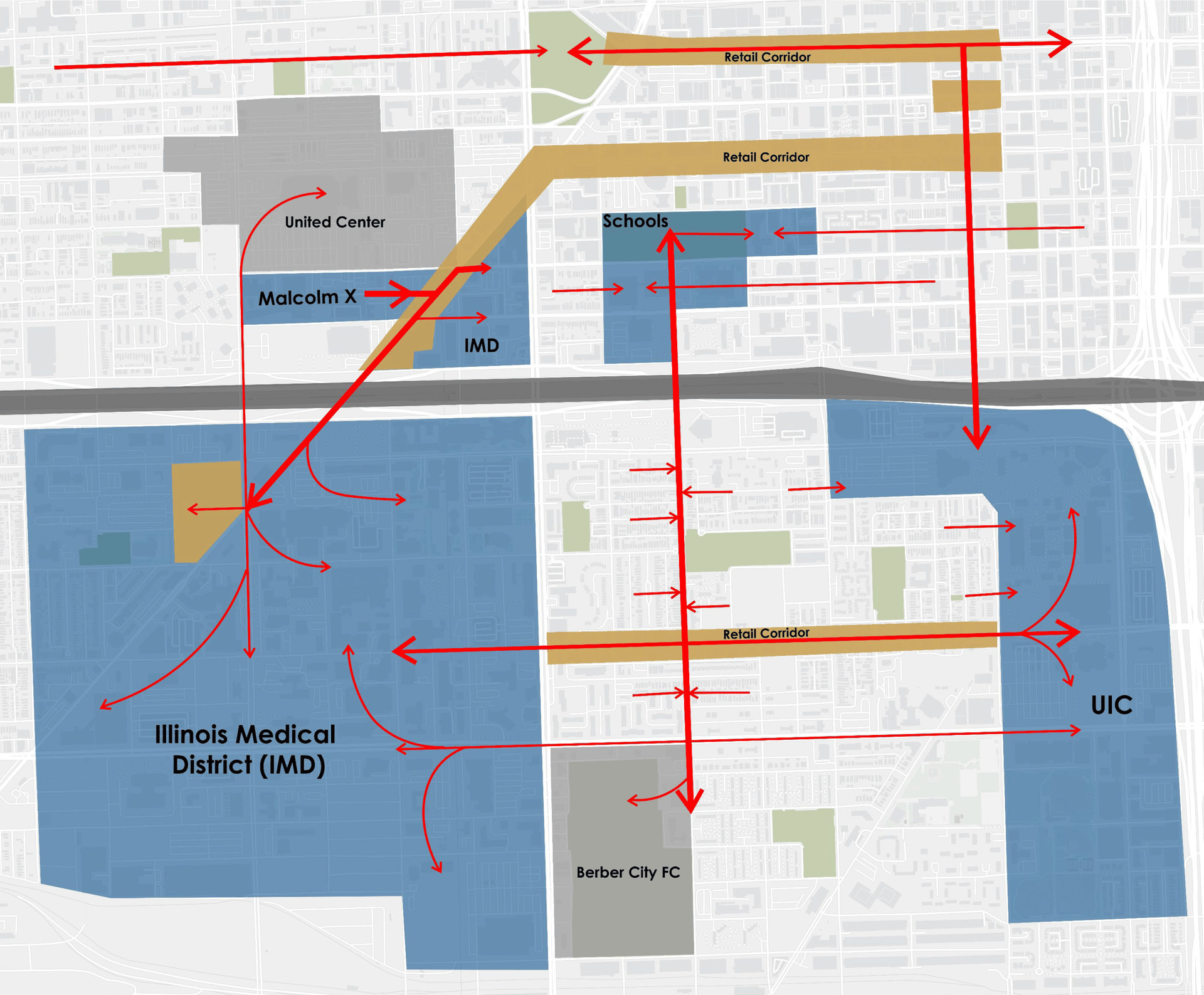
The Eisenhower corridor benefits from a relatively strong public transit foundation. Bus stops fall within a 2–5-minute walk of most parcels along the corridor, and the Blue Line's L-stops are accessible within a 5–10-minute walk — providing a reasonable baseline of mobility for residents, workers, and students moving between the Illinois Medical District, UIC, Malcolm X College, and surrounding neighborhoods. This transit accessibility is a genuine asset, one that any redevelopment strategy can build upon rather than reconstruct from scratch.
Yet the absence of safe last-mile connections between those transit nodes and key destinations means that car dependency persists well beyond what transit proximity alone would predict. Pedestrian routes are frequently interrupted at wide arterial crossings and key intersections, where the absence of crosswalks, push signals, and continuous sidewalks forces both residents and workers into unsafe, indirect paths. Cyclists face an equally fragmented landscape: bike lanes appear sporadically, ending without warning or dissolving into shared roadway. A network in-betweenness analysis confirms that these gaps are not random — they cluster precisely at the points of highest movement demand, where connectivity matters most.
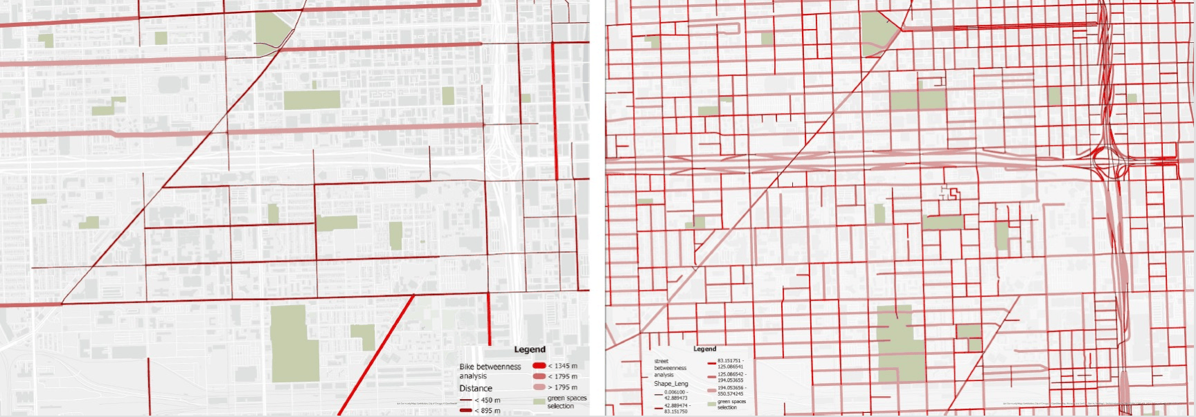
The Eisenhower corridor's deepest wound is not visual — it is infrastructural. Existing conditions reveal a near-total absence of safe, continuous routes for pedestrians and cyclists: sidewalks are narrow and poorly buffered, crosswalks are absent at key intersections near the freeway, bike lanes are inconsistent or missing entirely, and movement between the corridor's major anchors — Malcolm X College, the Illinois Medical District, UIC, and Little Italy — remains heavily car-dependent. A network in-betweenness analysis of the site identified concentrated clusters of movement deficit, particularly at wide arterials and freeway-adjacent crossings where pedestrian and cyclist exposure is highest.
Transportation, Connectivity & the Proposal
Rather than a continuous freeway cap — which would cost approximately $44 million in construction and generate roughly 14,197 tons of embodied CO₂e, equivalent to the annual emissions of 3,000 cars with a carbon payback period exceeding 200 years — this proposal advances a system of green bridges and targeted street improvements totaling $9.6 million. This lighter strategy reduces embodied carbon by approximately 94% (to ~872 tons CO₂e), avoids the air-quality "portal effect" that concentrated freeway caps create at tunnel mouths, and aligns with ESG frameworks including Justice40 and EJ screening tools.
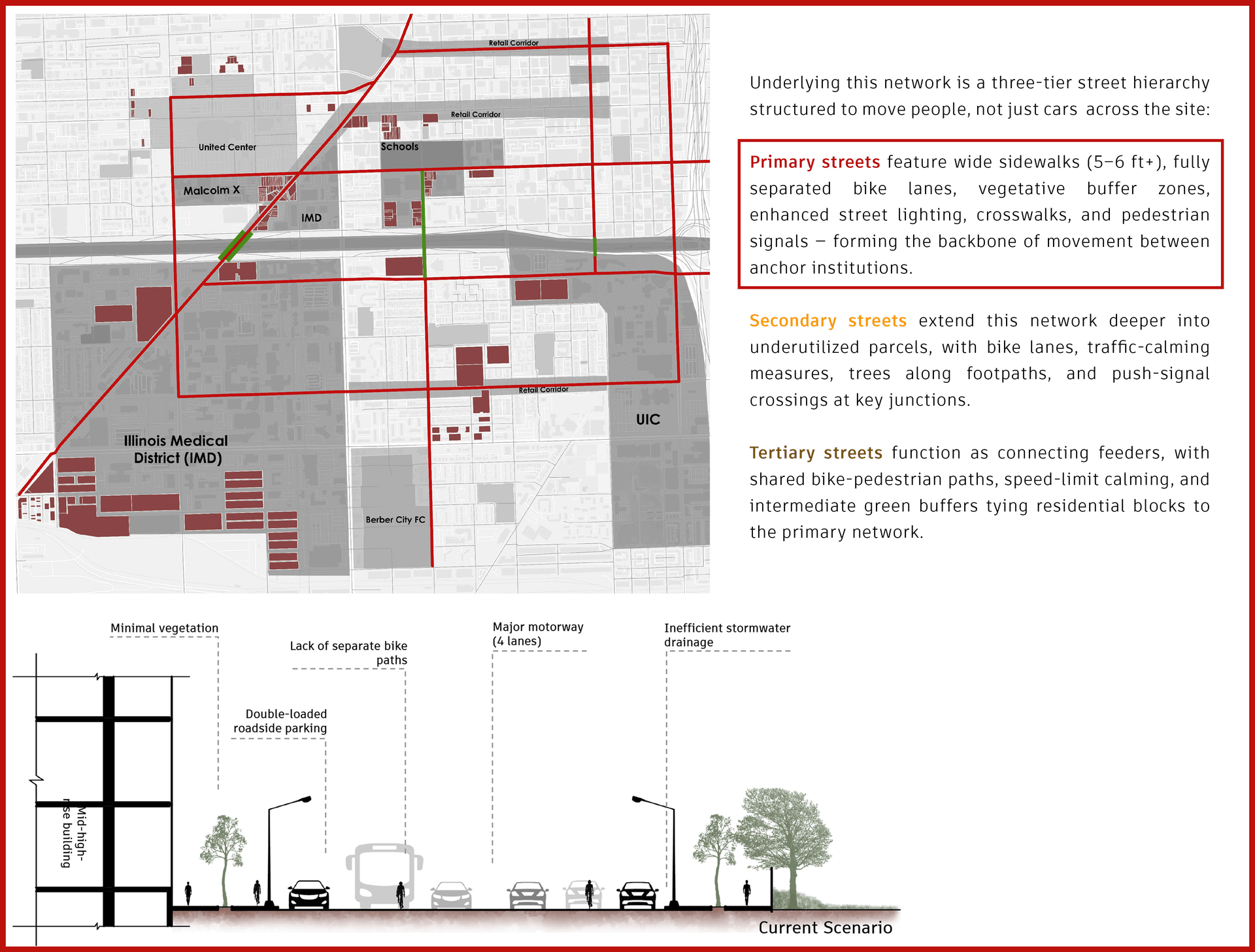
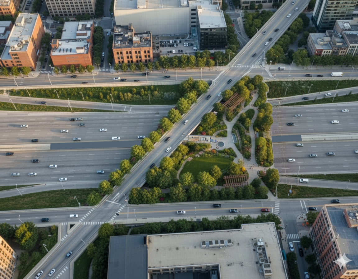
While the street hierarchy establishes the connective tissue of the corridor — structuring how people move through and across the neighborhood at grade — it alone cannot resolve the most critical ruptures in the urban fabric: the freeway crossings themselves. At three key locations along the Eisenhower, the gap between communities is most acutely felt, where pedestrians are exposed to high-speed traffic, cyclists have no protected route, and the freeway below acts as a psychological as much as a physical barrier. Rather than attempting to cap the entire corridor, the proposal targets these precise points of severance with three green bridge interventions — lightweight, landscape-driven upgrades along Ogden Avenue, Loomis Street, and Peoria Street — each calibrated to the specific communities, institutions, and movement patterns on either side of the freeway.
Bridge Improvement Strategies
Eisenhower Corridor · Chicago, IL
Development Plan - Nodes

The master plan organizes redevelopment into four strategic nodes across the 190-acre corridor, each calibrated to adjacent land uses, transit access, parcel geometry, and community-expressed priorities. The Gateway anchors the IMD entry with a mixed-use greenway activating Ogden Avenue through ground-floor retail, a maker space beneath the elevated rail, and a railyard park that converts underutilized parking into green public space. Moving east, the Education District layers residential infill — high-rises to the west, townhomes to the east matching the neighborhood's existing scale — with a jointly-used "Green School Park" modeled on Austin's Joint Use Agreement, and dedicated programming space for after-school nonprofits serving the growing student population. Further along the corridor, the Community Corridor builds on the rich existing neighborhood fabric through a townhouse-based urban form organized around shared courtyards, with mixed-use frontage along Taylor Street offering neighborhood-serving retail including a small-format grocery, café, pharmacy, fitness studio, and bookstore. Finally, the Live, Work, Play District brings together housing, office, and light industrial maker spaces — fabrication labs, micro-breweries, commercial kitchens — around a central green square that serves as the district's civic organizing room, creating a self-sustaining ecosystem of activity from morning to night.
The proposal's financial case rests on a 30-year master plan encompassing 8.28 million square feet of mixed-use development across 190 acres. Under current market assumptions, the project delivers a 9.55% IRR on a zero-acquisition-cost basis; with a $98.7 million land acquisition under top-market rents, it achieves a 10.02% IRR and a positive NPV of $3.98 million — while generating 6,610 permanent jobs, $295 million in wages, and $173 million in property and sales tax revenue over the project horizon. Infrastructure costs are kept deliberately lean: the green bridges and street improvements total just $9.6 million against the $44 million a full freeway cap would demand, freeing capital for development phased across an 11-year build-out from 2026 to 2037. This investment is structured to draw from a layered public-private funding stack — federal sources including the Reconnecting Communities Pilot Grant Program, BUILD/RAISE grants, and CMAQ funds; state contributions through Illinois DOT and Transportation Enhancement Programs; and local mechanisms including Tax Increment Financing districts, Special Assessment Districts, green municipal bonds, and public-private partnerships in which developers receive land or infrastructure offsets in exchange for civic programming.
Taken together, this proposal offers something rare in urban infrastructure: a strategy that is fiscally responsible, ecologically grounded, and socially restorative. By choosing lightweight green bridges over a carbon-intensive cap, targeting development in four nodes that respond to existing community fabric, and building a street hierarchy that puts pedestrians and cyclists before cars, the plan repairs 60 years of neighborhood severance without repeating the mistakes that caused it. The Eisenhower corridor's next chapter is not about engineering a bigger structure over the freeway — it is about stitching the city back together, one crossing, one block, and one community at a time.